

ADVERTISEMENT:
Local adventurer Dave van Graan is well-known for his lengthy walkabouts through Namibia. He is also an experienced safari guide with a vast knowledge of the indigenous fauna and flora and has taken his local and international clients on countless 4x4 expeditions across Africa over the years.
- Dave van Graan Tel: 082 772 6682
Hanglip Forest Reserve
After an absence of a couple of months on safari, local adventurer Dave van Graan is back again. This time he escorts us into our very own backyard where the Hanglip Forest Reserve offers nature lovers its countless treasures - whether you like hiking, biking, bird watching, or just cruising through the pine plantation and forest: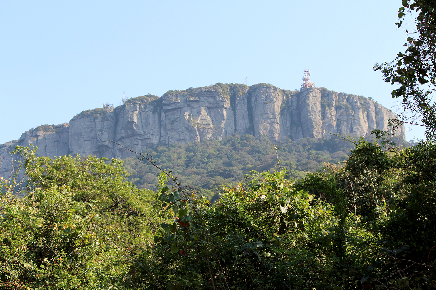
Summer lies before us, and it is time again to get off the couch and enjoy some much-needed fresh air. How fortunate we are to be surrounded by such beauty, splendour, and diversity, living here in the Soutpansberg area!
Now, if there is one thing that is literally impossible for local residents to miss, it’s the Hanglip plantation that borders Louis Trichardt and the towering cliffs of the Hanglip (Songozwi) peak. With an elevation of 1719 meters, this is the second-highest peak of the Soutpansberg mountain range.
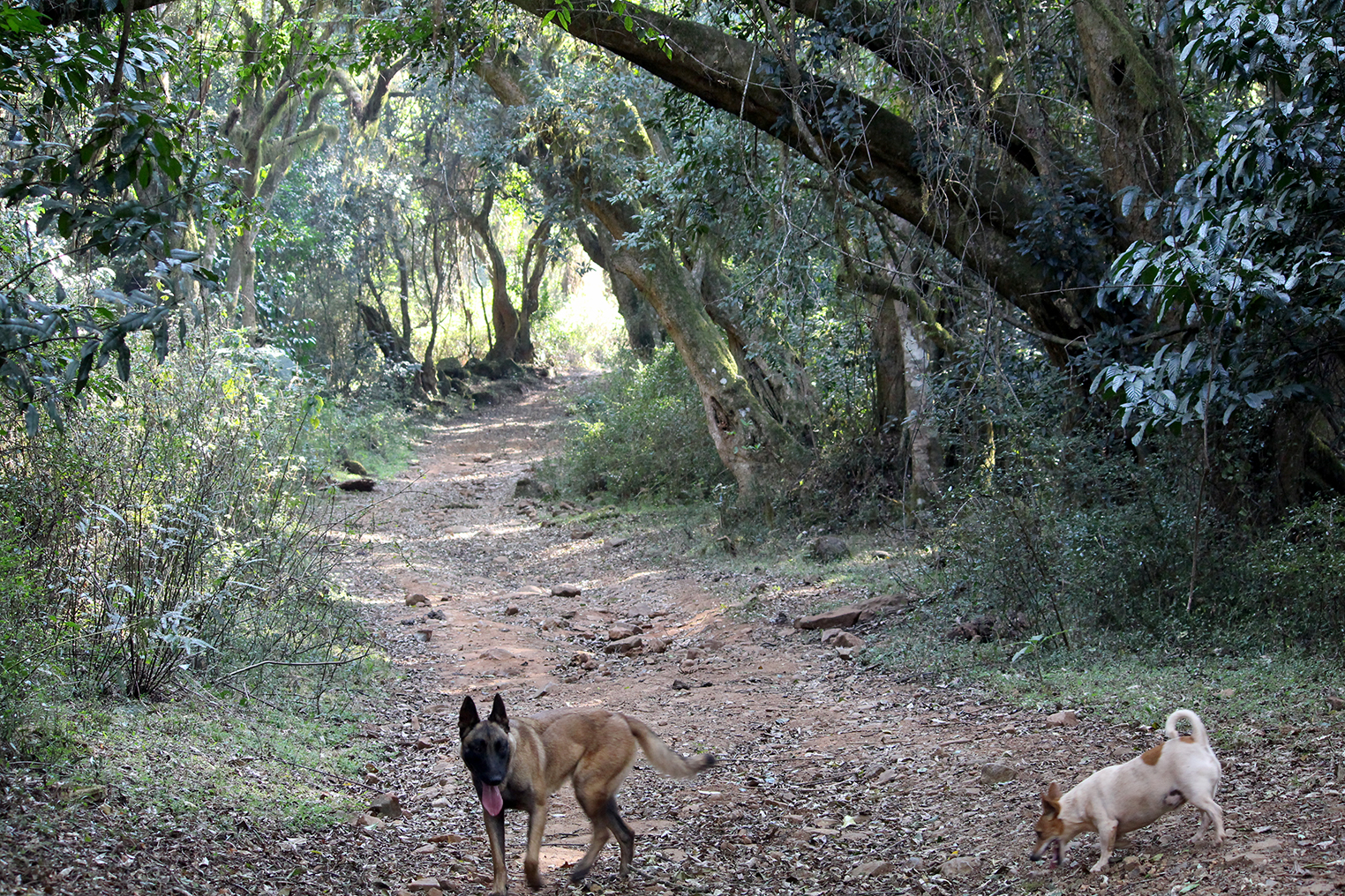
Living in the heart of this plantation, I have the privilege of frequently taking hikes through the Hanglip Forest Reserve, or Hanglip Bosreservaat as it is locally known, which covers an area of 340 hectares. Kilometres of road lead through these pine plantations and indigenous forest, which, after the summer rains, turn into a scene from a fairytale. I often meet the odd mountain biker or hiker on my walks, but I would really like to see more people enjoying this jewel that sits right on our doorstep.
For the hiker, this truly is nature at its best. The walk up through the pine plantation is refreshing, with the fragrance of thick vegetation and rich soil, mingled with pine trees, growing stronger as one ascends deeper into the forest.
 |
If you are a bird lover, you are in for a genuine treat. The greater Soutpansberg area has a total of 510 indigenous bird species that represent 56% of Southern Africa’s birdlife. The Hanglip Forest Reserve is a very popular attraction for bird watchers with such a large variety of bird species that can be found here, including the crowned eagle (Stephanoaetus coronatus). At Camp Africa is a nesting pair of this majestic bird of prey that has been breeding in the same tree for more than 20 years. Other interesting species include the crested guineafowl (Guttera pucherani), blue-spotted wood dove (Tutur afer), colourful sunbirds, Narina trogons, loeries, the petite African paradise flycatcher, and many, many more.
Tree spotting is another activity that has become quite popular, and with 540 species of indigenous trees in the Hanglip Reserve, this is the tree spotter’s paradise. The thick Afromontane forest areas are especially beautiful after the rains and when the thick mist hangs over the mountain. The hanging moss and old man’s beard give the forest a spooky appearance and the avid photographer will have plenty of opportunities to take great pictures.
Because of the abundance of trees and vast vegetation, thousands of butterflies and moths make the forest their home. There are about 309 different butterfly species in the greater Soutpansberg area, of which many can be found in the Hanglip Reserve area.
For those who prefer a little more adrenaline, there are a few signposted mountain bike routes that range from 8 to 22 kilometres. The routes are a good mixture of existing gravel roads and more technical single-track sections through the bush.
 |
Here and there you will find demarcated picnic spots with very rudimentary braai facilities that blend in perfectly with the scenery and complete the whole “out in the forest” experience. If you do not feel like walking or cycling, you can always just drive around the reserve in your vehicle. I do, however, suggest that you use a vehicle with high ground clearance because the roads can be rocky and rough in places. During the rainy season, one should be careful not to drive into very remote areas in the reserve as one can get stuck in the mud.
Of course, there are also quite a few viewpoints where you can stop and enjoy the breathtaking views over the forests and Louis Trichardt Town below.
There is no need for bookings to enter the reserve. Simply pass through the entry gate where a minimal fee is paid, and you can drive around the reserve at leisure.
Lajuma Peak
This week, adventurer Dave van Graan’s adventure involves some 4x4 driving, outstanding scenery, flowers in abundance, great heights and a really tough hike.
For my next trip, I decided to invite three of my fittest friends along on a challenging hiking trip, so we put on our sturdiest hiking boots and braced ourselves for the day ahead.
Destination: Lajuma Peak.
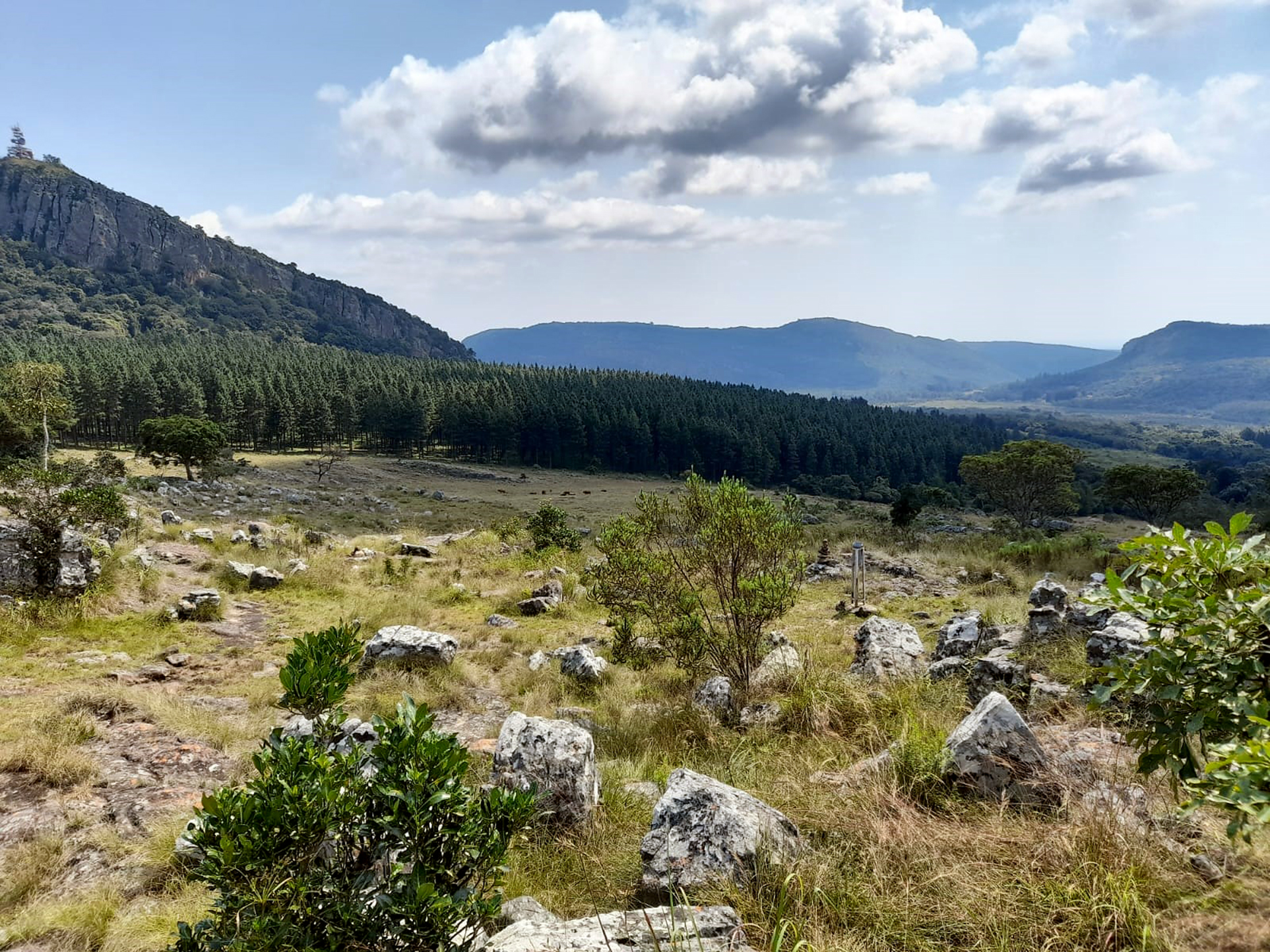
The route: Mount Lajuma is the highest point of the Soutpansberg mountain range. Taking the R522, we drove approximately 45km towards Vivo until we found the turnoff to the Lajuma Leopard Research Station on the right (at coordinates S 23°02’21.46” E 029°26’58.96”). We had arranged permission and entry in advance with Jan Crafford, the head of the Leopard Research Station at Lajuma, to hike this iconic mountain peak. At reception, we were directed accordingly.
The access road is rough in places, and in certain areas a 4x4 or high-clearance vehicle is definitely required. Because of all the rain, we encountered a few fallen trees along the route, which we had to drag out of the way. As the road is also very narrow, we had to drive slowly to prevent too much damage to the body of the Land Cruiser. The road was extremely rough at times, but the vehicle made it through in the end. (Jan mentioned that all the routes would be cleared in future).
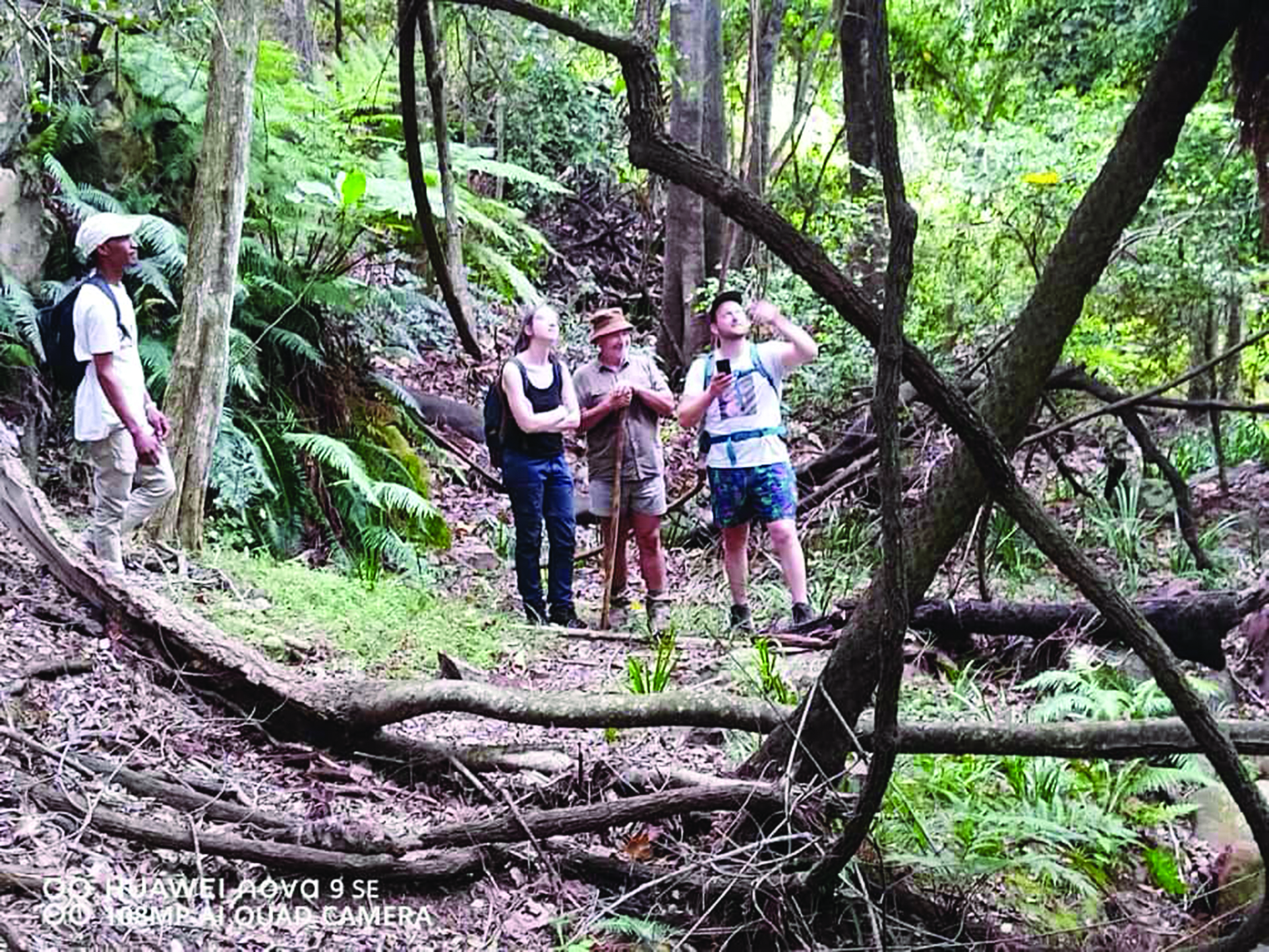
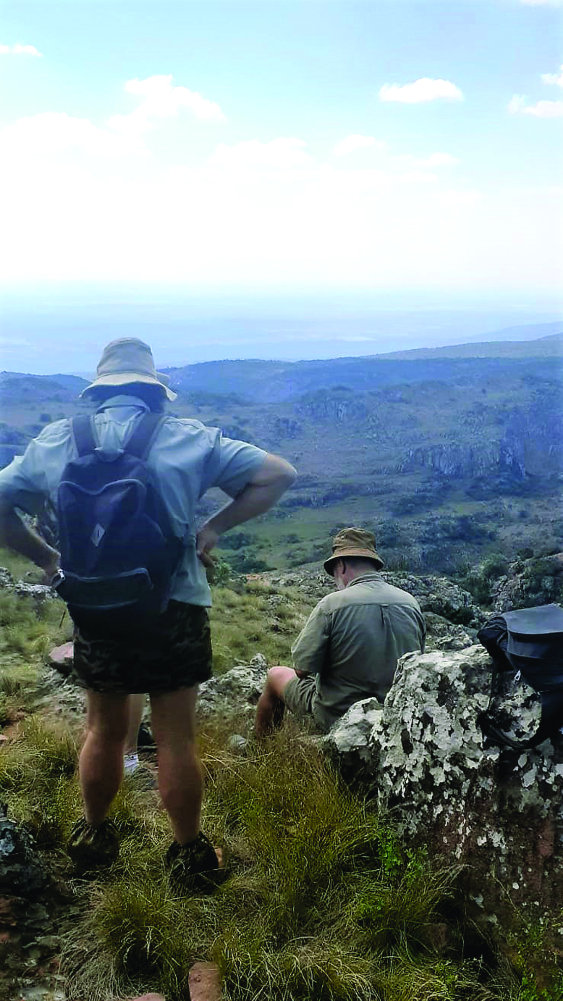 Getting to the starting point of the hiking trail took a little longer than expected, which meant it was already quite hot by the time we started our hike. Standing at the bottom of Lajuma felt very intimidating, and although all four of us were relatively fit, the walk up the mountain proved to be a proper challenge.
The route was easy enough to follow, being clearly marked with small piles of stone. Some places were exceedingly steep, so we took things slowly, stopping every now and then to take a drink of water and catch our breath. The track was covered with loose rocks, which made the going slippery and dangerous, so we were very careful and helped each other at the more difficult spots. We took time to appreciate and photograph a variety of wildflowers along the route.
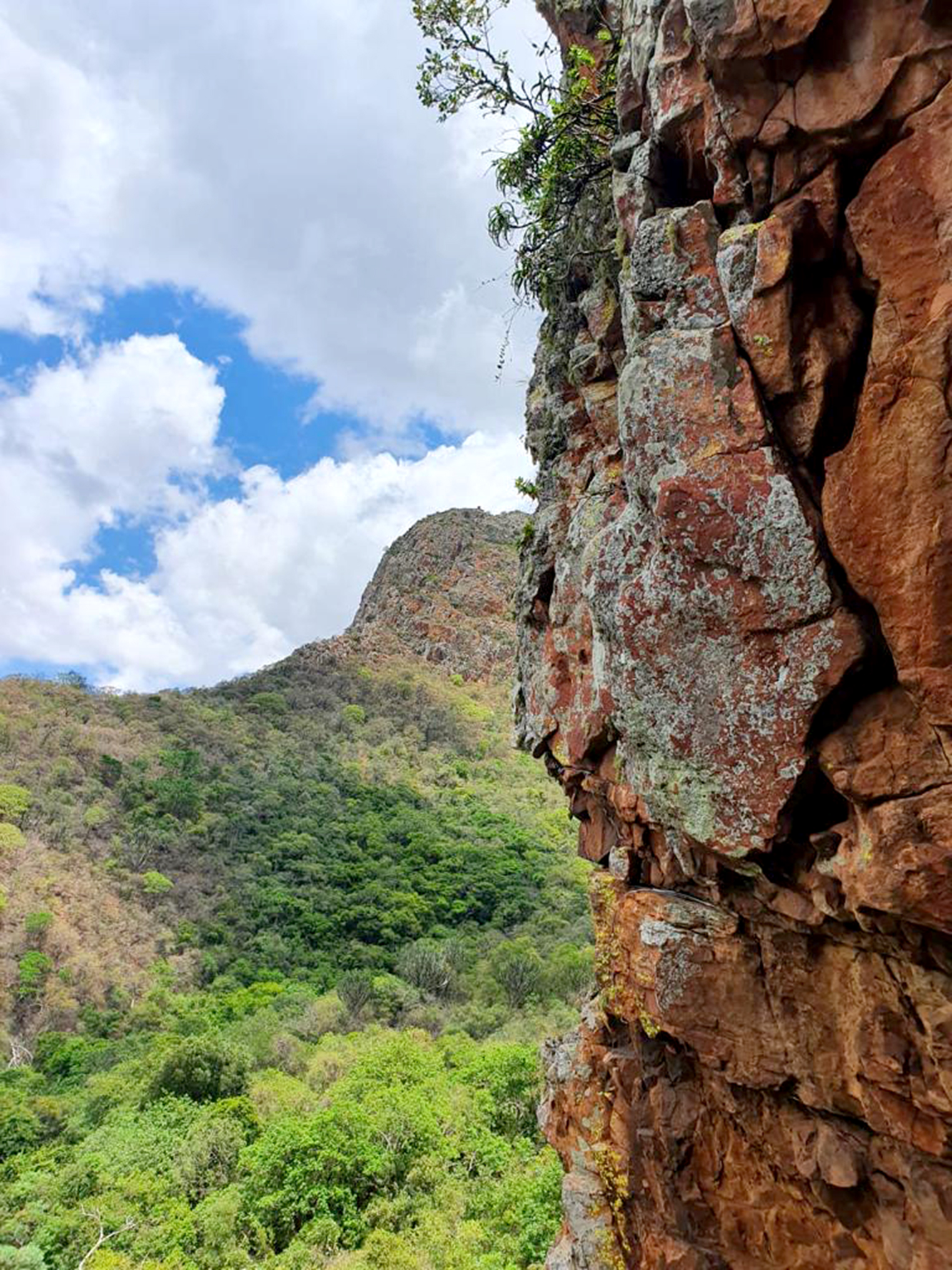
Jan was spot-on when he told us that reaching the top would take about an hour and a half, which is 1 747m above sea level. After very hard walking, and with a great sense of achievement and high-fives passed around, we finally reached the trigonometric beacon, where we took some more photos and enjoyed the incredible view from our vantage point.
Going down was hard on the legs, but this time it took us only 30 minutes to reach our vehicle at the bottom, where we rewarded ourselves with an ice-cold beer.
On the way out on the Vivo Road, we made a last pitstop at a spectacular waterfall (which I strongly recommend). The fall is approximately 30m high, and after the recent rains, it was breath-taking to see the water mass cascading down the vertical cliff.
Lajuma is a special place and definitely worth the effort. Even if you do not feel like climbing the mountain, the serenity and beauty of the place will make your visit one to remember.
Jan also mentioned that a campsite will be available in the near future. Visitors can contact him on 082 353 4421 for more information.
Camp Mangwele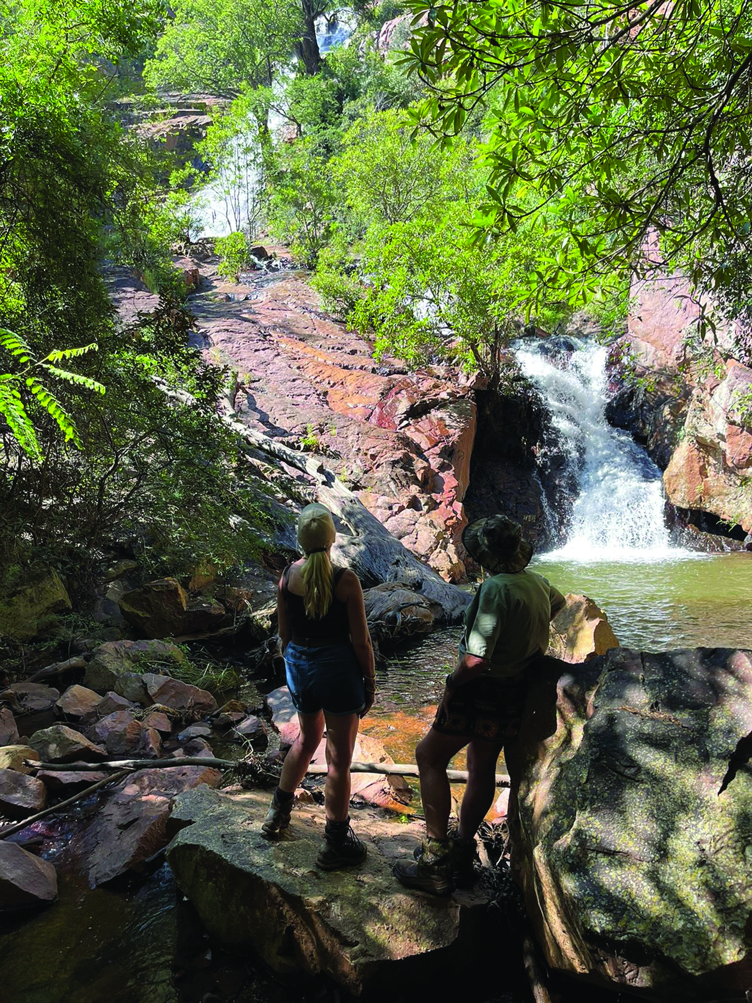
Dave’s next excursion takes him and a group of friends on another scenic camping trip, this time to Camp Mangwele, in the heart of Venda.
I just love to explore the old Venda Land area because it offers so many scenic routes and places to visit. Over the years, I did numerous guided tours to the so called “Land of Legends”, and this time it was decided that we would drive through Mambas Pass to Camp Mangwele.
Destination:
Camp Mangwele is situated in the Mutale area, approximately 51.5km from Louis Trichardt.
The route:
Leaving Louis Trichardt at around 09:00 in the morning, we took the Witvlag Road, in the direction of Siloam. Once on the R532, look for the Lake Fundudzi turnoff. This road will take you up a very steep tar
red road, which is still in good condition. The turnoff towards Mambas Pass is not marked, so it is important to take a GPS along. The coordinates for this elusive turnoff to the left are S 22°50’08.00” E 030°14’55.41”.
 This road has only one gate. Once you drive through it, the road deteriorates and starts to descend into the valley below. Engaging the 4x4 low range while driving a steep downhill road like this to prevent you from using the brakes for long periods, which can cause the brakes to overheat, is always a good idea. Then, drive slowly and just enjoy the scenery and beautiful view over the Nzhelele Dam in the distance.
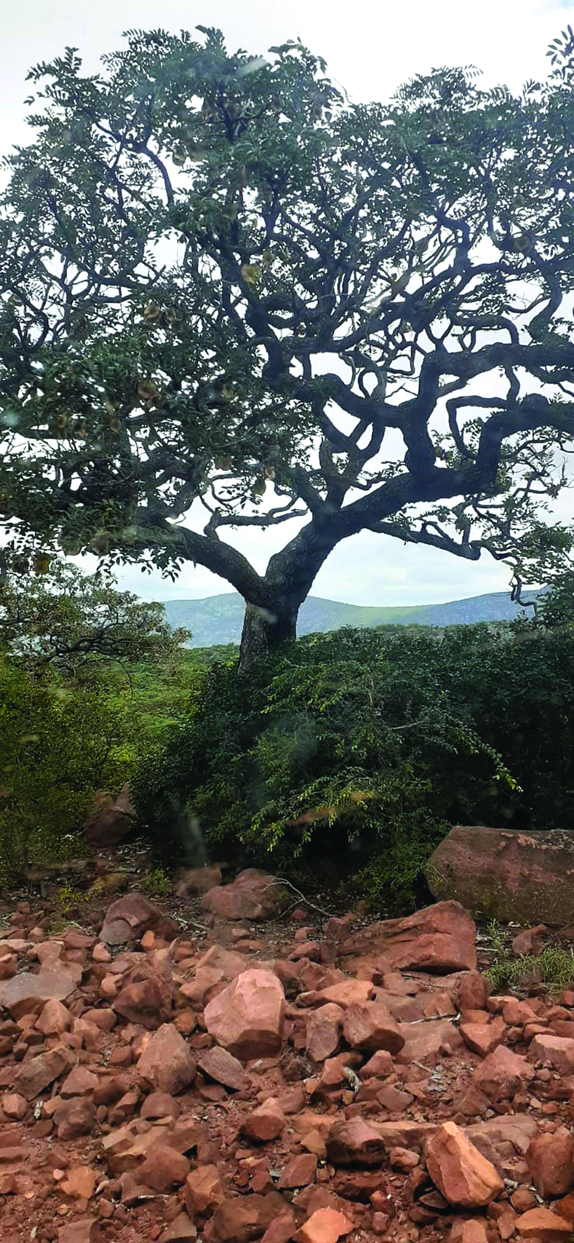
We spotted a huge variety of trees and plants as we made our slow decent down Mambas Pass. We had two ex-game rangers among our group, and they enthusiastically shared their knowledge of the bush with us. They were particularly fond of the trees in the area and gave us some fascinating facts on the local flora. Some of the more common trees we saw were the Silver Leaf Terminalia (terminalia siricea), Purple Pod Terminalia (terminalia prunoides), Kiaat (pterocarpus angolensis), which reminds one of a Pierneef painting, and of course everyone’s favourite, the intriguing Baobab (adansonia digitata).
Once we reached the bottom of the pass at coordinates S 22°47’ 28.02” E 030° 15’ 01.53”, we turned left towards Camp Mangwele (S 22° 47’ 04.91” E 030° 17’ 27.62”). We arrived around lunch time, which gave us ample time to enjoy the camp setting. Henry, the camp attendant, was there to welcome us and was very friendly and efficient.
The camp is set under huge wild fig (ficus sansibarica) and waterberry trees (syzygium cordata). We quickly pitched our tents and, while some opted for an afternoon nap, others went for a walk around the camp and up to the small waterfall. Henry brought us a few piles of wood for our evening braai and even started our fire for us. He also lit the donkey geysers, and before long, we could all enjoy nice hot showers. The ablutions are old but solid and clean. The water comes from the river, so make sure to bring your own drinking water.
We had a peaceful night’s rest, falling asleep to the soothing sound of the small gurgling stream that runs through the camp in the background.
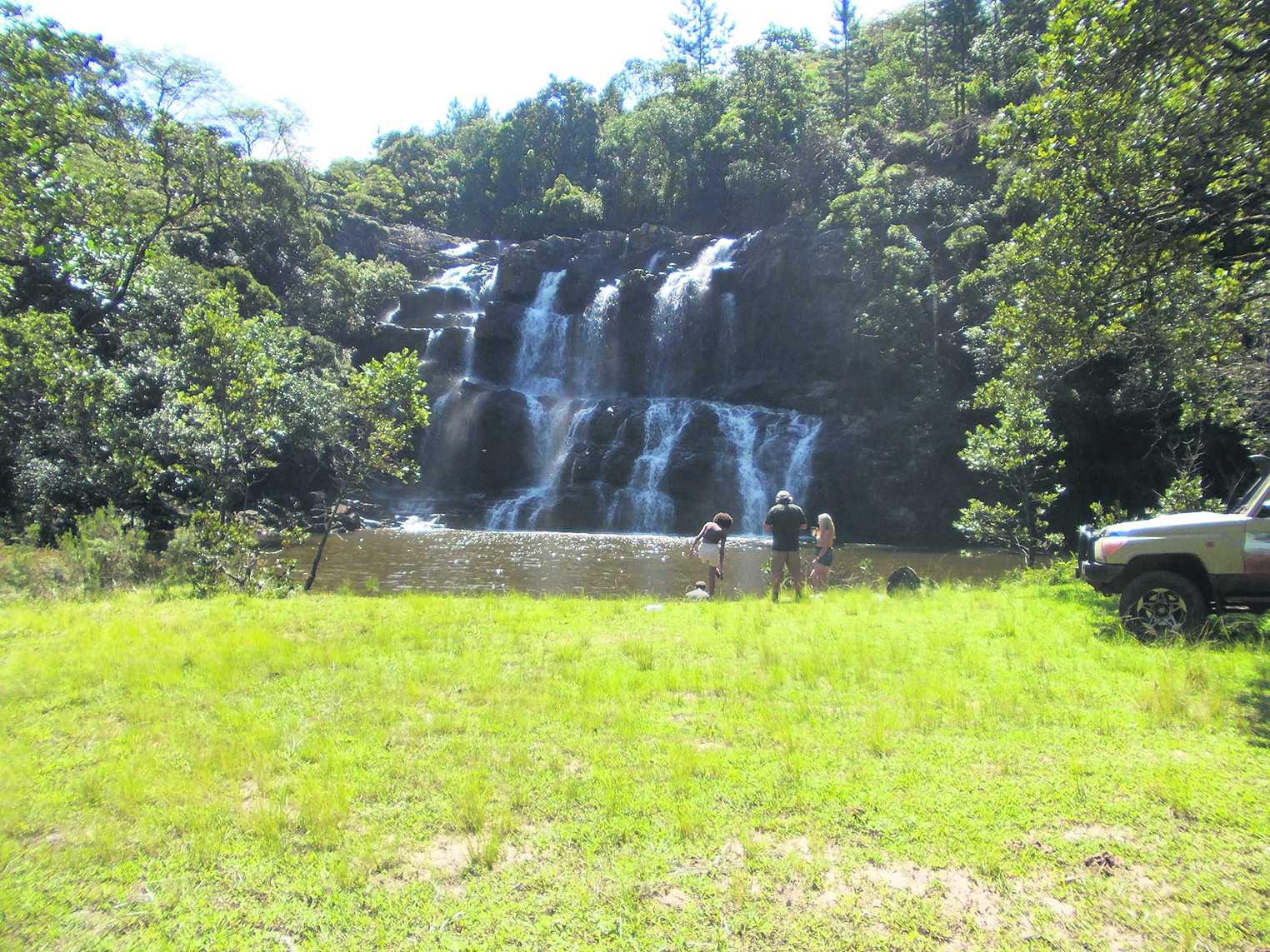
After coffee and rusks early the next morning, we left Camp Mangwele, first stopping at another big waterfall (coordinates S 22°47’02.78” E 030 17’30.340”) on the way through Gogogo village, before we eventually found our way back to the N1 and Louis Trichardt.
Venda Land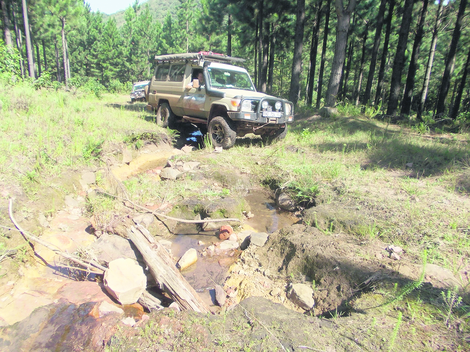
Dave shares his most recent expedition this week – an adventure-packed road trip with his friends through Venda Land, along enigmatic lakes, a sacred forest, and a beautiful sinkhole with a dark history.
Summertime is adventure time, and over the long weekend in March, I thought it a good idea to take a trip to Venda Land again. We had some friends from Pretoria and Ethiopia visiting for the weekend, so I decided to show them a few of the popular local sightings, such as the Holy Forest and Lake Fundudzi in the Thathe Vondo wilderness, the Tshatshingo Potholes along the Tshirovha River at Makwarani village, and some of the surrounding waterfalls, whilst driving along the scenic routes.
We left Louis Trichardt in two Cruisers early in the morning (with me in the lead) because it is about a 200km round trip. Taking the Witvlag Road, we drove to the Thathe Vondo area, where the off-road section starts. The view over the Thathe Vondo Dam and the Tshivhase tea plantation, which you pass on this road, for me, really is one of the most beautiful sights, especially after all the rain we have had recently. The main roads were not too bad, so we were making good time and were on our way to the 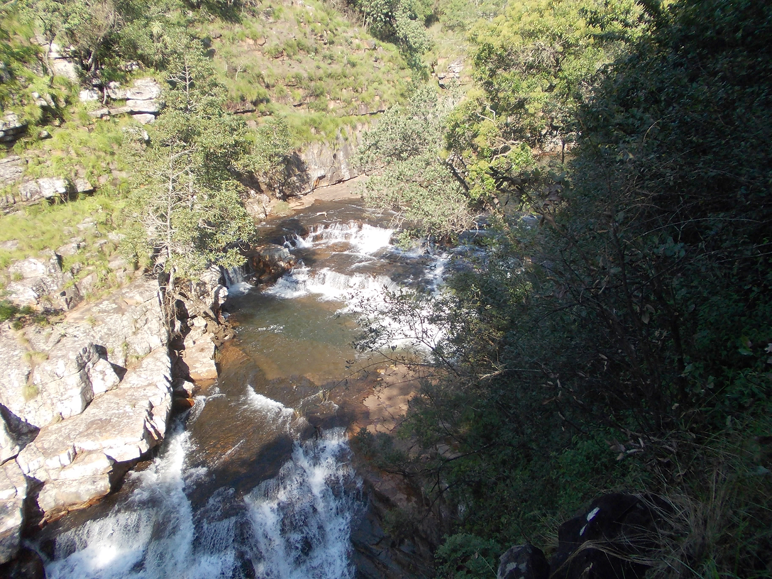 Holy Forest. Soon, however, Mother Nature decided to throw us a curveball. We were halfway through the Holy Forest when we came upon a massive fallen tree lying right across the road and blocking our way. After much deliberation, we decided that the tree had won and we were forced to turn back and change our route. I use TRACKS FOR AFRICA as tracking software on my GPS device, which helped a lot in finding a new route through the labyrinth of tracks.
The deeper we went into the forest, the worse the roads became, but we were able to reach the Tshirovha Falls for a quick visit. From there, we proceeded to the Mukumbani Waterfall, where one finds a clean picnic area with a stunning setting to enjoy a picnic lunch. People can even take a refreshing swim in the cool waters below the waterfall. Hundreds of small fish almost “attack” one’s feet to nibble at the dead skin. This reminded me of the fish
spas I visited in Turkey years ago.
Once everyone had had something to eat, we set out for the Potholes. The road ahead, however, was i
n a serious state of deterioration - deeply eroded by the rains - and we were clearly the first vehicles in a very long time to brave the drive up into the mountain. The going was really tough, especially with the roads still being wet, and the poor Cruisers were roaring and spinning and sliding dangerously. At times, we were forced to fill the deep slots in the road with rocks, practically bu
ilding a surface to drive on.
The view was spectacular enough that none of the passengers wanted to be inside the vehicles at that point, especially when the Cruisers leaned precariously to the sides. Our guests opted rather to take videos and photographs than join the fun in the cars.
Slowly we made progress, and at last we were back on better roads again. We finally arrived at the Potholes, to everyone’s relief. The entry fee here is R20 per person and includes a guide that shares interesting information
about the Venda culture and the fascinating stories around the Potholes themselves. Legend has it that, in olden times, local witches were drowned in the potholes, which must have been a terrifying sight, but today they are appreciated for their n
atural beauty and are definitely
a must-see if one is in the area. A lovely lodge that goes by the same name is situated there. Although I have never stayed there myself, it looks neat and modern, with lovely surrounding gardens.
The day’s travelling was long and on rough roads, but the scenery made up tenfold and we made our way back home with another exhilarating experience to share.
Buzzard Mountain Retreat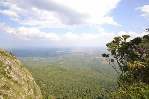
This week, Dave tackles an exciting 4x4 trail at the picturesque Buzzard Mountain Retreat. He shares his personal experience of his surroundings and the 4x4 route in particular, with some valuable advice to go with it.
Since hiking is not always practical in the rainy season, I thought it best to put away my hiking boots for my next adventure. Recently, a few of my old school friends came to visit and I decided to take them out for a proper drive. So, I filled up my trusted Land Cruiser with fuel, packed some food and drinks for the road, along with our camping gear, and off we went to take on one of the best 4x4 trails in the Soutpansberg mountain range. Luckily, the weather turned out to be sunny and pleasant.
Destination:
Buzzard Mountain Retreat. Situated approximately 17km from Louis Trichardt towards Vivo on the R522 Road, the place is well signposted and easy to find on the right.
The route:
The 4x4 trail here is quite technical and excellent for challenging one’s 4x4 driving expertise. It is not that long, approximately an hour’s drive in total, but there is also the option to camp overnight for those who want to extend the experience, which we did.
I love this place because it is quiet and peaceful, with few people around, and the scenery is incredible with its high cliffs and abundance of fauna and flora.
 Note: There are quite a few farm gates to open and close, so my advice is to take a willing travelling companion along.
The first part of the trail leads up to the campsite. Make sure to engage 4x4 before driving up the mountain, as it can become very dangerous if the vehicle starts to slip in 2-wheel drive. It is a slow, winding and sometimes very washed-out track after the rains, which demands an experienced level of 4x4 driving. There is also a very steep drop to the left on the way up, so you must be fully in control of the vehicle. Especially when the track is wet. (I do not recommend at all going up then).
It takes some patience with all the gates, but eventually you get to a plateau where the huge, open campsite lies in wait. There are bathroom facilities, though rustic (being in the bush). Then there is a picnic spot as well where day visitors can also stop for breakfast, brunch or lunch, or to just enjoy the lovely views.
The best time to camp out at Buzzard Mountain Retreat would be on a cloudless, full-moon night. For me, it felt quite spooky with the moonlight shining on the high cliffs and the sound of the owls hooting in the distance, but it was an incredibly serene experience. The scenery and sights from the campsite were indescribable.
Note: Remember to take your binoculars along when you go because there is a pair of Verreuax’s eagle (Aquila verreauxii), also called the black eagle, that patrols the high cliffs for hyraxes (rock rabbits, better known as dassies), which is their primary food source. There are also many other interesting and colourful bird species to see, such as the Narina trogon, purple-crested turaco (loerie) and paradise flycatchers, to name but a few.
After a good night’s rest at the campsite, we tackled the second part of the trail. Here, things got more difficult as the road from there is really rough. I decided to engage low range and at times even connected diff-lock just to make it easier on the vehicle and more comfortable for the passengers. It was very bumpy and slow going, but worth every second.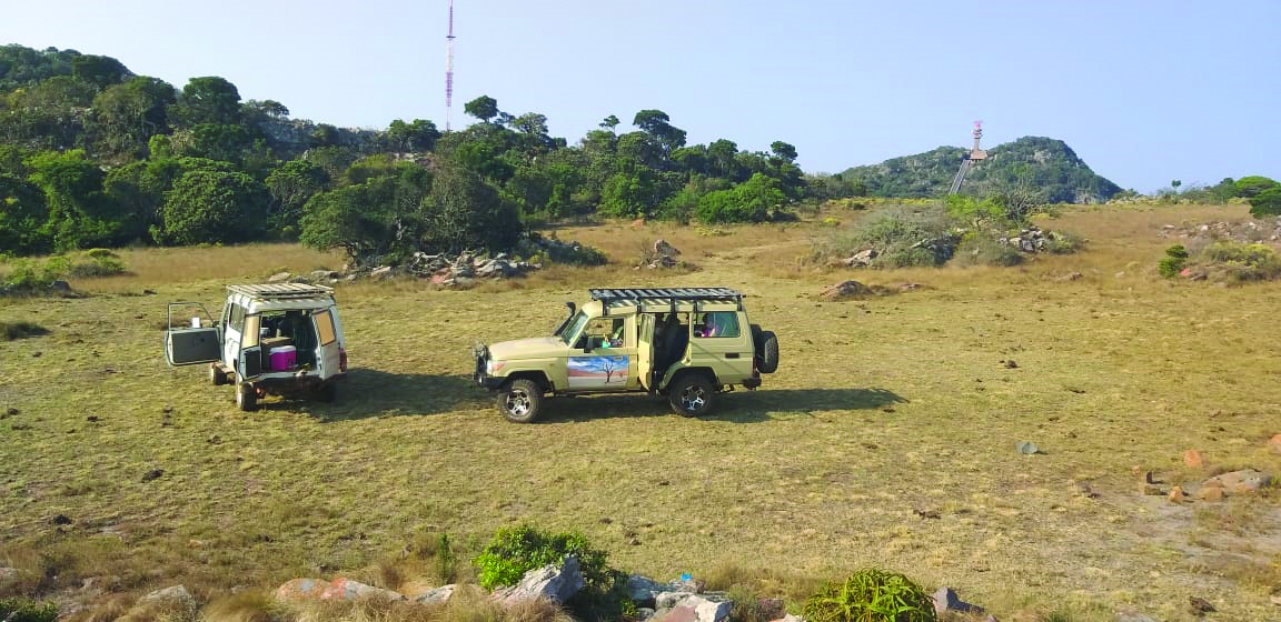
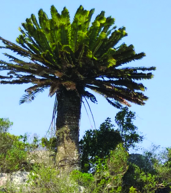
At the next plateau, at the top, the view towards the south was magnificent. You can see the Vivo Road and Makhado Air Force Base in the distance from there. I was once again taken with the indigenous giant cycads that grow there. The flora here reminds one a little of the Cape fynbos.
When driving down the mountain, be very careful and make sure to engage 4x4 low range until you reach the bottom.
And so, with our souls properly nourished again, we returned to Camp Africa in a state of total exhilaration. A worthy experience indeed.
For more information about Buzzard Mountain Retreat’s 4x4 trail and other facilities, contact the owner, John Greaves, on 083 473 6208.
Buysdorp
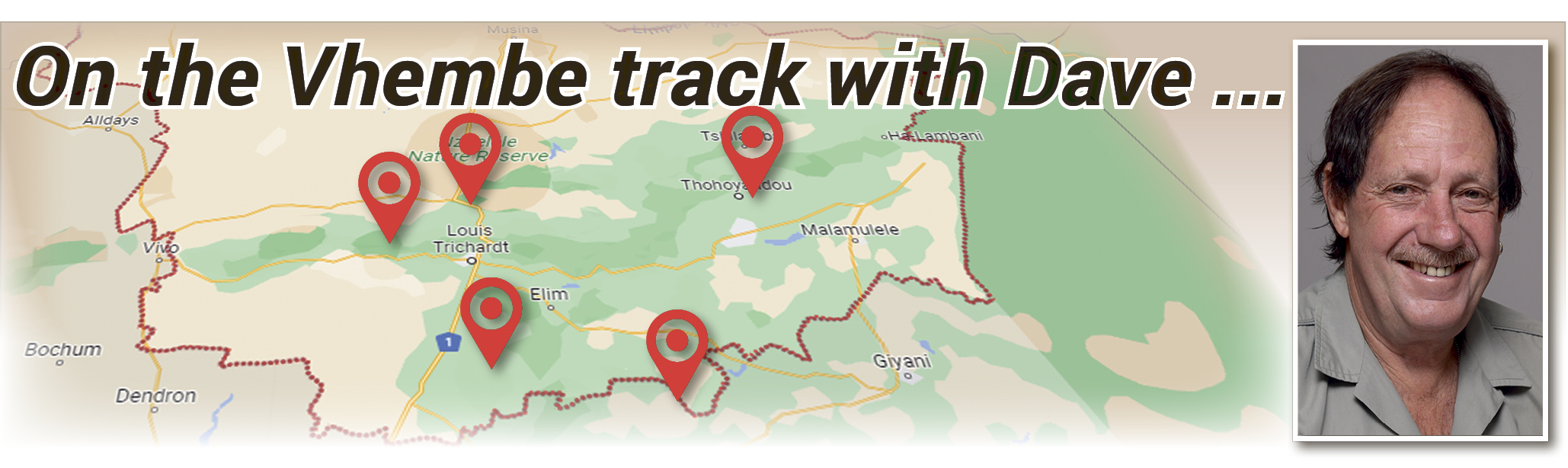
The Zoutpansberger introduces a new column in this edition, called On the Vhembe track with Dave.
Local adventurer Dave van Graan will be sharing his travelling finds of interesting places around the Vhembe area with our readers. Dave is well-known for his walkabouts through Namibia. Last year, we covered another one of his epic walks from the Epupa Falls in Kaokoland to Henties Bay over a distance of almost 800km. Dave is also an experienced safari guide, who has taken his local and international clients on 4x4 expeditions in his Land Cruiser across Africa. This column will appear once a month, so look out for his next trip. But first, Dave takes us to a breathtaking waterfall north of Buysdorp.
After the 1994 elections and the new dispensation, the world opened up for South African passport holders, and suddenly we could travel all over the world. I decided to take advantage of this new freedom and, after sharing my ideas with some people, I got a group of 12 South Africans together. This was before Google and GPS navigators, so it was with a great sense of adventure, apprehension, and real maps and compass that we tackled this expedition. It took us two months to drive from Cape Town to London.
It was not long after I returned from this trip that I decided to leave my day job as a paramedic and pursue the life of an adventurer. Ten Trans Africa expeditions and many shorter ones later, I have visited 27 African and 15 European countries with my own vehicle. I always looked to find the remotest places and have visited more than 100 national parks. Over the last 30 years, I drove close to a million kilometres in Africa.
With all this traveling experience, I would now like to showcase the Vhembe area. There are so many beautiful places to see and, with the permission of some of our farmers, I want to visit as many of them as I can. We live in a very special part of South Africa, with fauna and flora endemic to this area, numerous waterfalls and stunning scenery. Some of these places will be open to the public and others will not. Some of the places I intend to visit will require a certain level of fitness, since we will have to walk long distances, while others will be outright dangerous, due to steep inclines and difficult rocky terrain. I plan to do a few 4x4 routes to hidden places as well, where we will test our skills behind the wheel. Then I also want to visit a few nature reserves in the area
 First destination:
Buysdorp - a small village with a big history.
Background:
Buysdorp is situated 14km from Vivo on the R522. This small village was named after Coenraad de Buys (1761 -1821), who was a real wild man and is sometimes described as an outlaw and rebel. However, with his impressive size of almost seven feet tall, he is said to have been a remarkable man. Coenraad loved the local girls and allegedly fathered as many as 315 children. Paul Kruger later granted the “Buys people” this particular area to farm and start a village.
The route: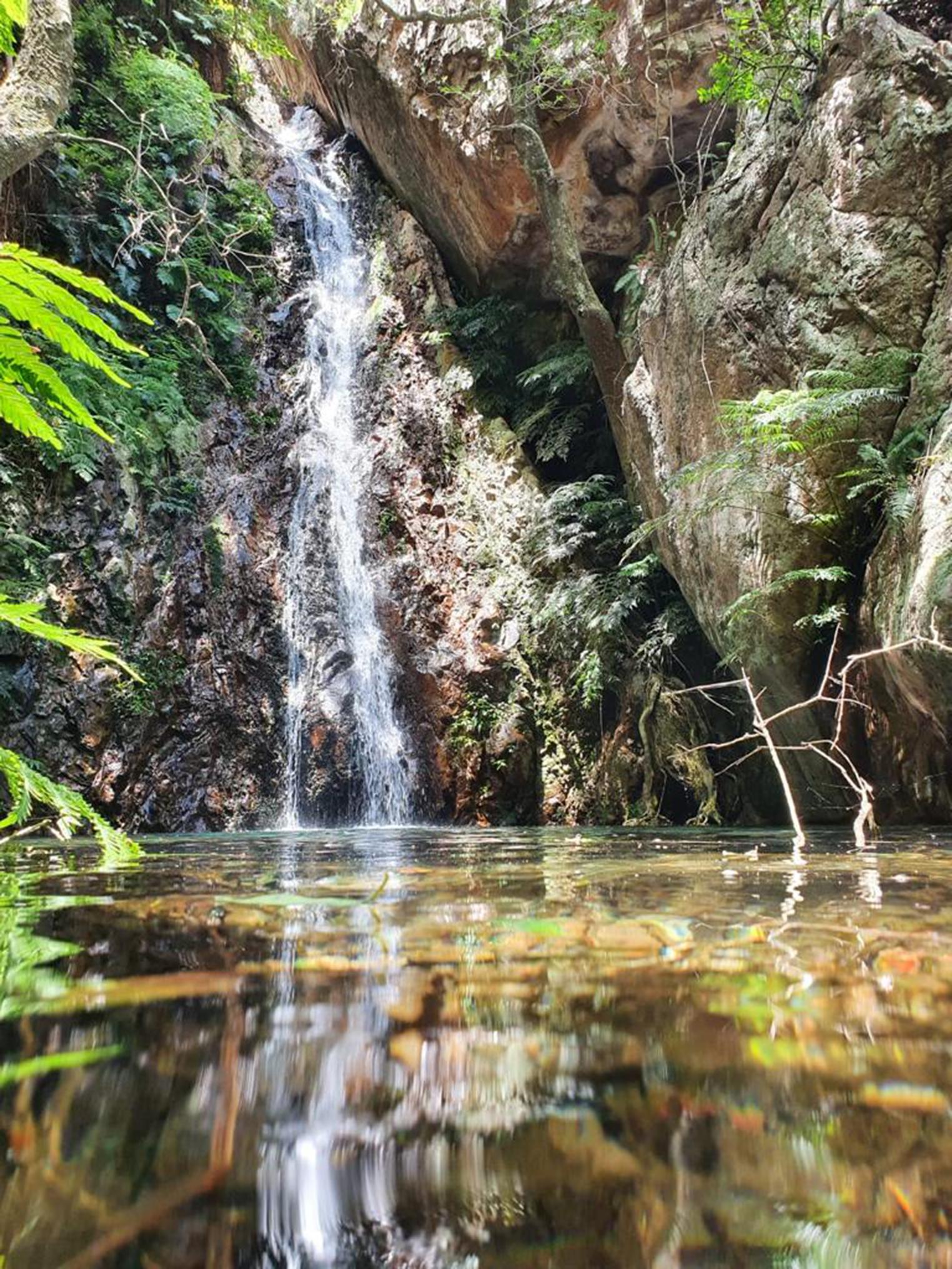
I was told about a beautiful waterfall north of Buysdorp and I just had to visit the place, so a small group of us set out for Buysdorp early one Saturday morning in October last year, where we met Keannen Buys, the local guide. Keannen is quite knowledgeable and kept us interested with all kinds of information. It is not a very difficult walk, although there are a few rocky areas and the few children who came along managed well. It took about an hour’s walk from the parking area, where we had left the vehicle, to the falls. And what a sight it was!
The water from this waterfall supplies Buysdorp with some of its water, so they prefer that people do not swim in these very inviting pools. The scenery along the river is typical of our area; huge tree ferns and water-berry trees were abundant. There is nothing as relaxing as sitting next to a small stream, listening to the water as it burbles over the rocks.
The best time to visit will be in the rainy season to ensure that the waterfall is in flow. Pack a picnic lunch and enjoy the peace and quiet of this magical place.